-
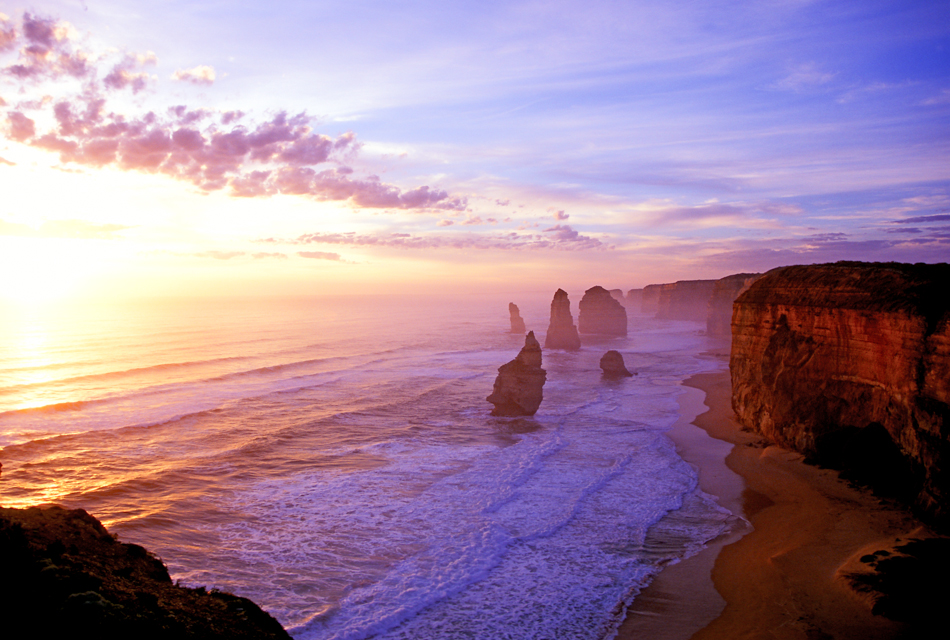
These limestone pillars rise out of the Southern Ocean in the National Park. 20 million years ago – they were connected to the cliffs of the mainland. The waves and wind carved them into caves, then arches, and eventually weathered them down into columns that rise up to 45 metres high.
The elements continue to erode the stacks at a rate of roughly two centimetres a year. Today only eight stacks remain.The London Arch was part of a natural double-span bridge until 1990 when the arch closest to the shore collapsed. Another 50 metre tall Apostle fell in 2005.SC101 Sunset, Twelve Apostles Marine National Park, Victoria950,640 -
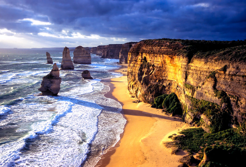
These limestone pillars rise out of the Southern Ocean in the National Park. 20 million years ago – they were connected to the cliffs of the mainland. The waves and wind carved them into caves, then arches, and eventually weathered them down into columns that rise up to 45 metres high.
The elements continue to erode the stacks at a rate of roughly two centimetres a year. Today only eight stacks remain.The London Arch was part of a natural double-span bridge until 1990 when the arch closest to the shore collapsed. Another 50 metre tall Apostle fell in 2005.SC102 Sunset, The Twelve Apostles Marine National Park, Victoria950,647 -
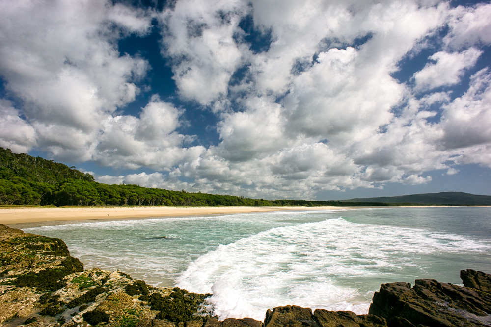
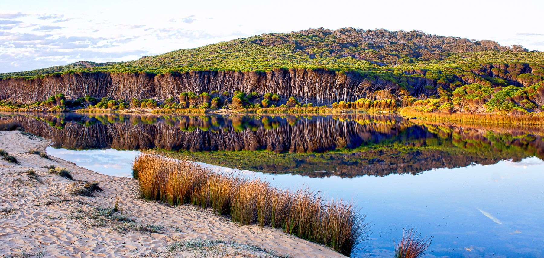
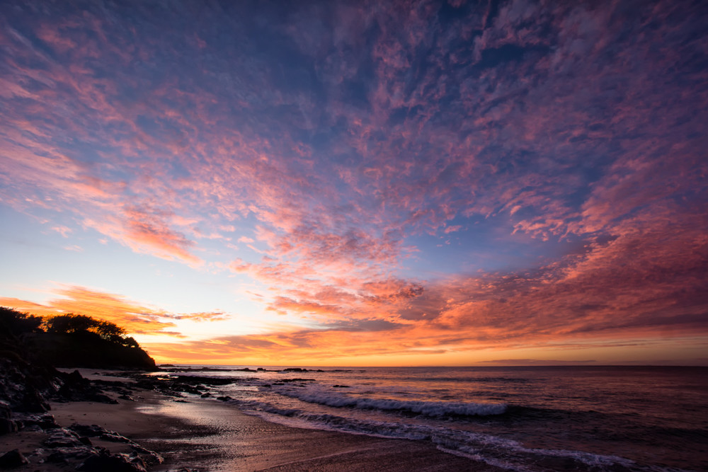
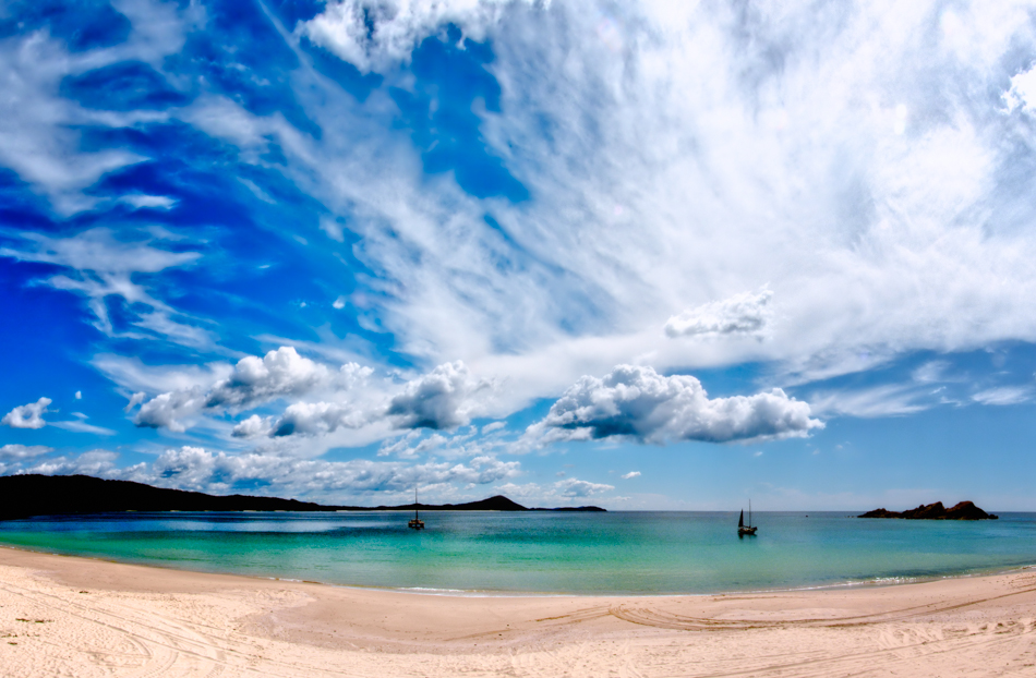
Nadgee Nature Reserve is a protected area on the far south coast of New South Wales, to the immediate south of Ben Boyd National Park. Its southern border is the state border with Victoria, where it abuts Croajingolong National Park.
A short scenic drive from the town of Wonboyn past Wonboyn Lakes through Nadgee Nature Reserve brings you to Greenglades on Disaster Bay - four kilometres of pristine beach.
SC103 Disaster Bay, Nadgee Nature Reserve NSW1000,667 -
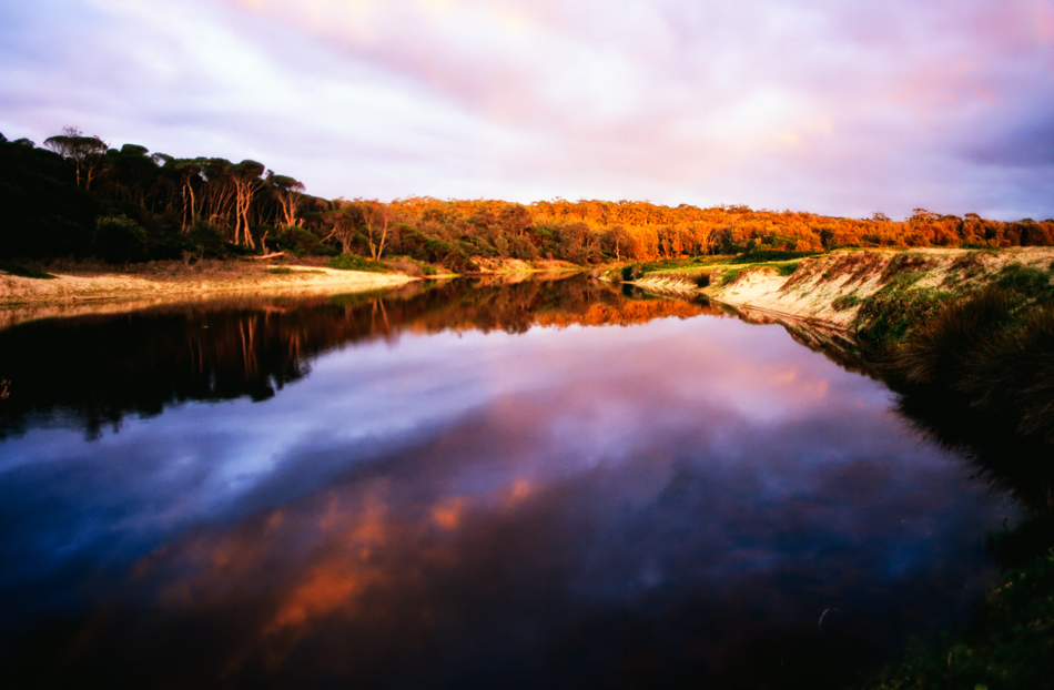
Ben Boyd National Park on the south coast of NSW near the town of Eden was established in 1971. Originally 8,900 hectares in size, it has been expanded to 10,486 hectares.SC104 Saltwater Creek, Ben Boyd National Park NSW950,634
-
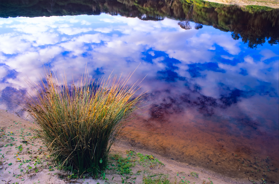
Ben Boyd National Park on the south coast of NSW near the town of Eden was established in 1971. Originally 8,900 hectares in size, it has been expanded to 10,486 hectares.SC105 Saltwater Creek, Ben Boyd National Park NSW950,622
-
Ben Boyd National Park on the south coast of NSW near the town of Eden was established in 1971. Originally 8,900 hectares in size, it has been expanded to 10,486 hectares.SC106 Saltwater Creek, Ben Boyd National Park NSW950,625
-
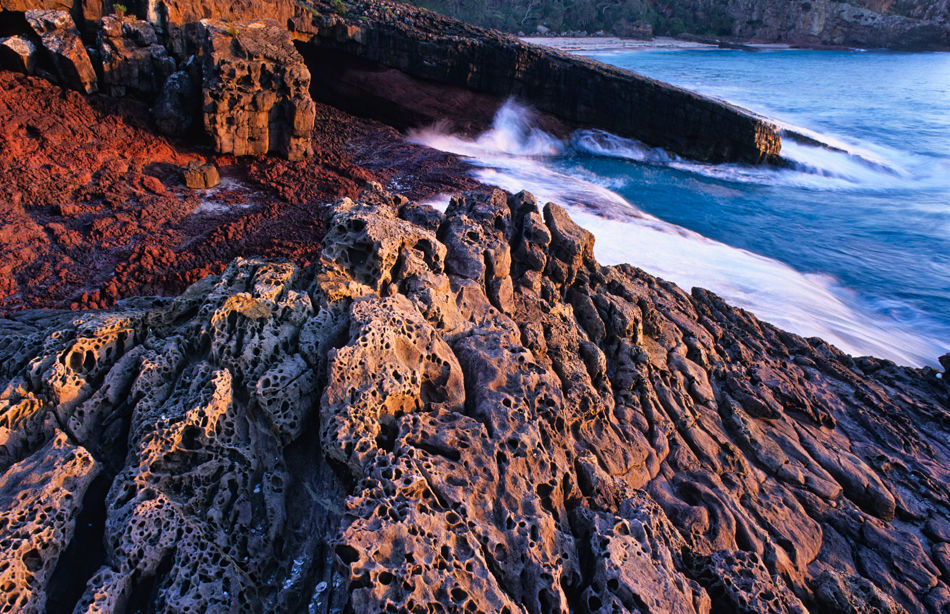
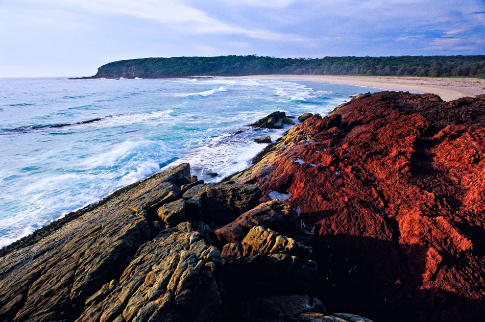
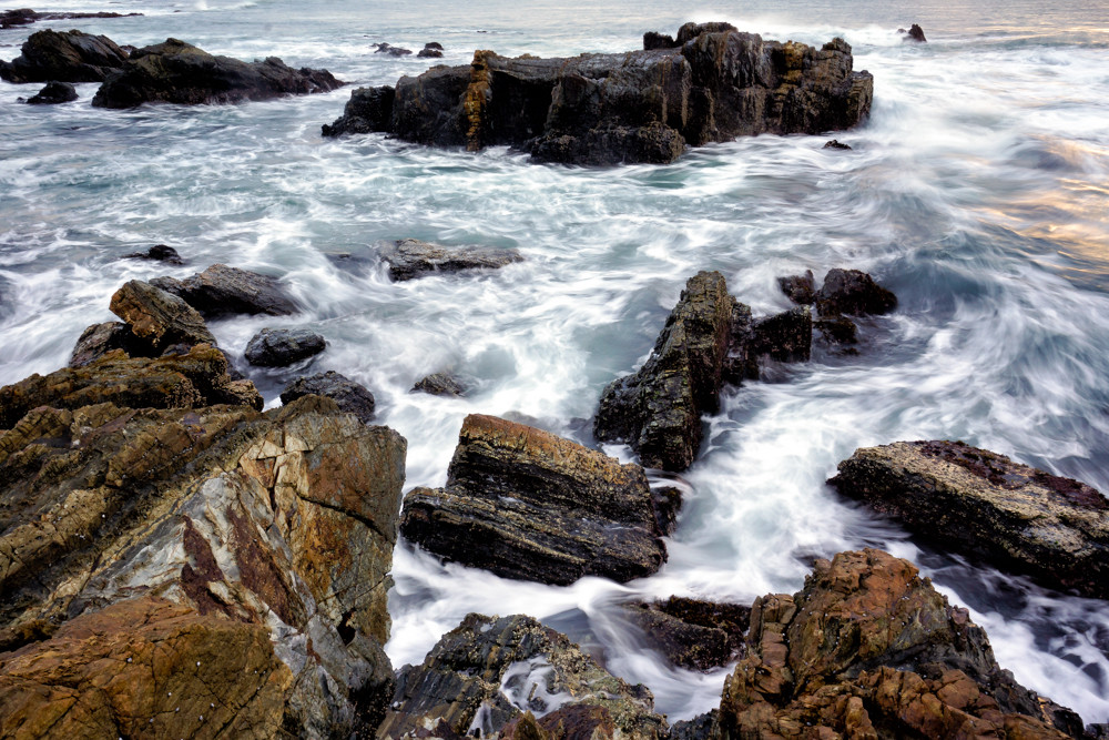
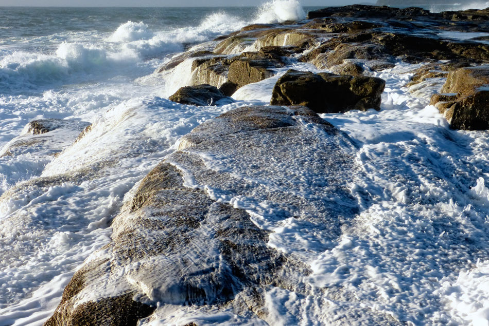
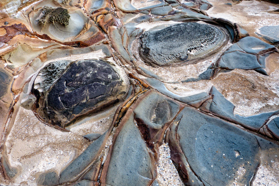
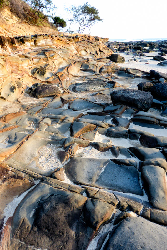
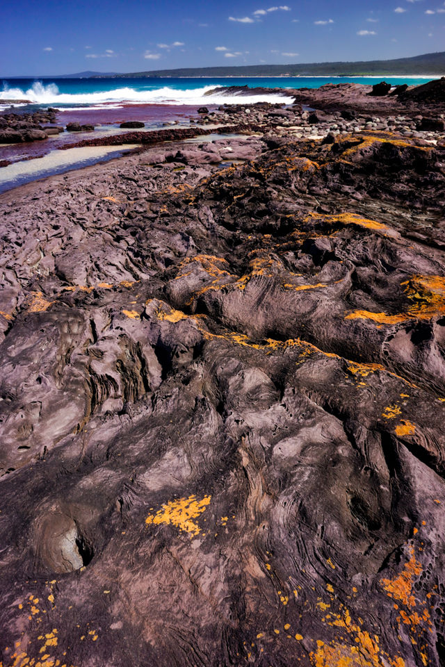
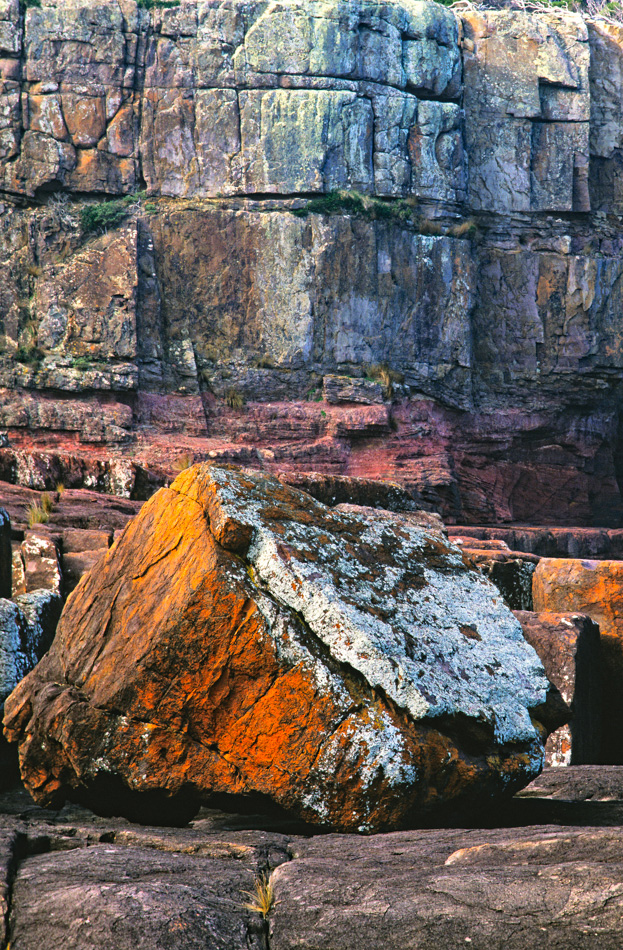
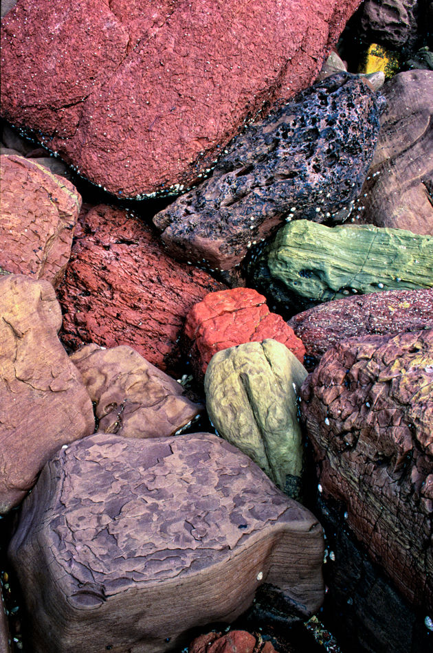
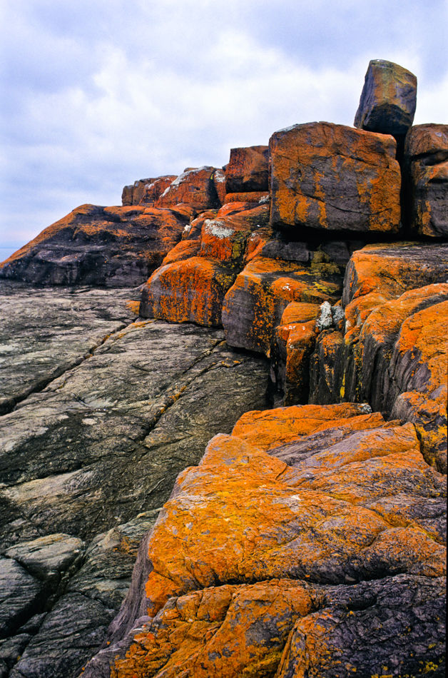
Rock formations near Saltwater Creek, Ben Boyd National Park on the south coast of NSW near the town of Eden was established in 1971. Originally 8,900 hectares in size, it has been expanded to 10,486 hectares. It is an area of Geolgical sites of NSW.SC107 Rock Formations near Saltwater Creek, Ben Boyd National Park NSW950,614
-
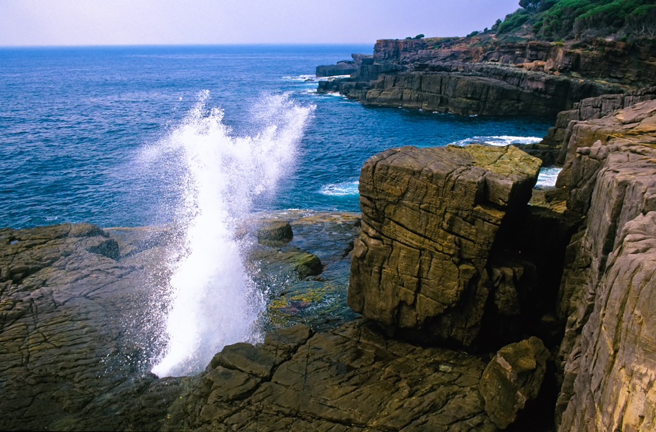
Rock formations near Saltwater Creek, Ben Boyd National Park on the south coast of NSW near the town of Eden was established in 1971. Originally 8,900 hectares in size, it has been expanded to 10,486 hectares. It is an area of Geolgical sites of NSW.SC108 Blowhole, Ben Boyd National Park NSW950,626
-
Rock formations near Saltwater Creek, Ben Boyd National Park on the south coast of NSW near the town of Eden was established in 1971. Originally 8,900 hectares in size, it has been expanded to 10,486 hectares. It is an area of Geolgical sites of NSW.SC109 Rock Formations near Saltwater Creek, Ben Boyd National Park NSW950,631
-
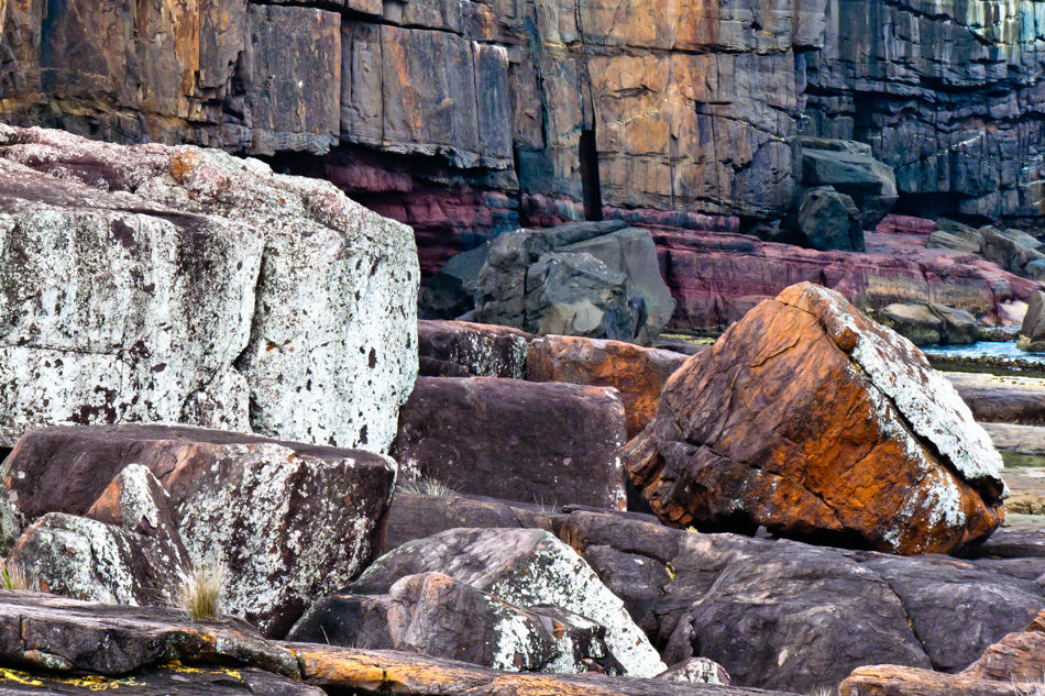
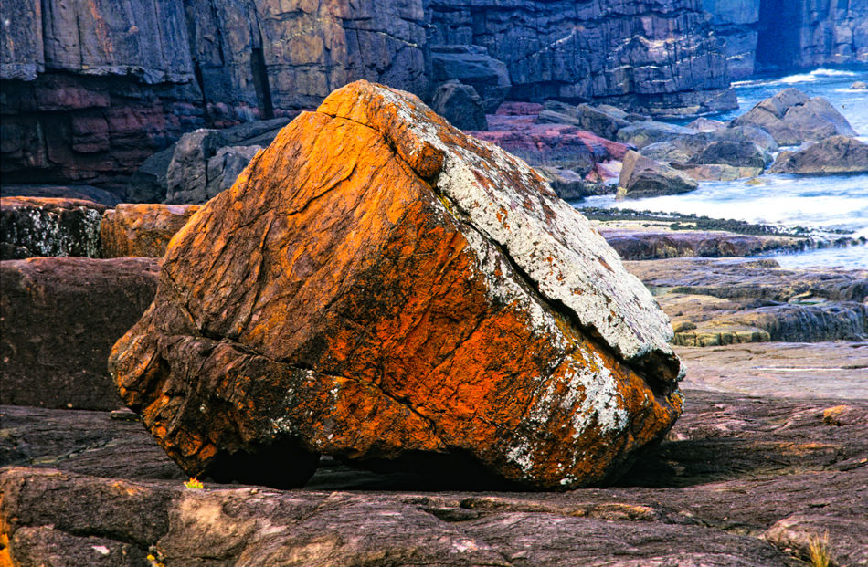
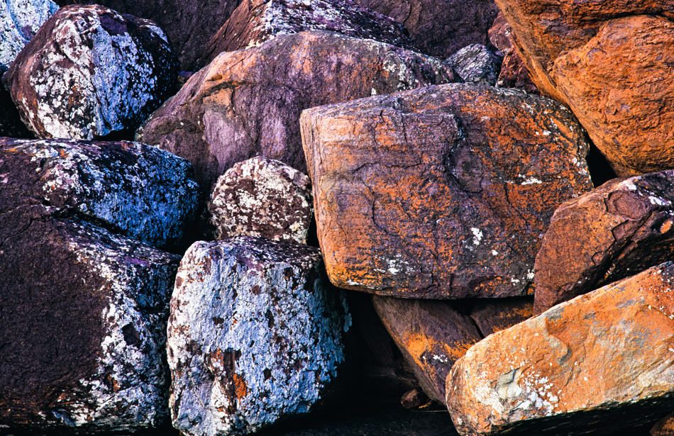
Rock formations near Saltwater Creek, Ben Boyd National Park on the south coast of NSW near the town of Eden was established in 1971. Originally 8,900 hectares in size, it has been expanded to 10,486 hectares. It is an area of Geolgical sites of NSW.SC110 City Rock area, Ben Boyd National Park NSW950,633
-
Rock formations near Saltwater Creek, Ben Boyd National Park on the south coast of NSW near the town of Eden was established in 1971. Originally 8,900 hectares in size, it has been expanded to 10,486 hectares. It is an area of Geolgical sites of NSW.SC111 City Rock area, Ben Boyd National Park NSW950,621
-
Rock formations near Saltwater Creek, Ben Boyd National Park on the south coast of NSW near the town of Eden was established in 1971. Originally 8,900 hectares in size, it has been expanded to 10,486 hectares. It is an area of Geolgical sites of NSW.SC112 City Rock area, Ben Boyd National Park NSW950,615
-
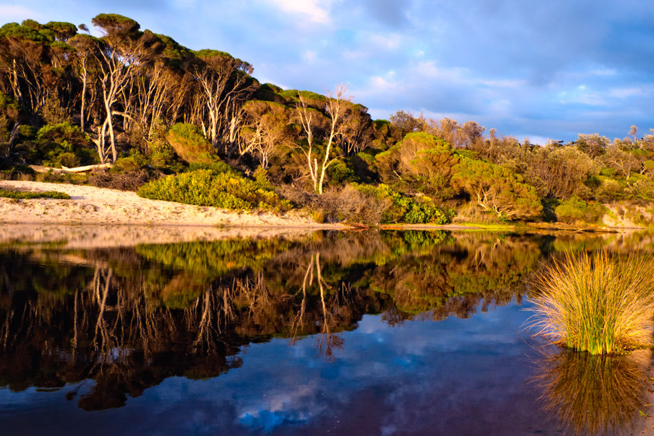
Coastal lagoon in Bournda National Park on the south coast of NSWSC113 Bournda Lagoon, Bournda NP NSW1800,856
-
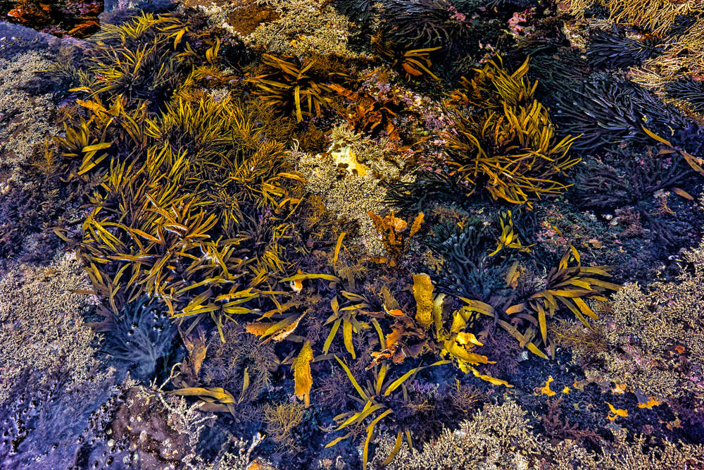
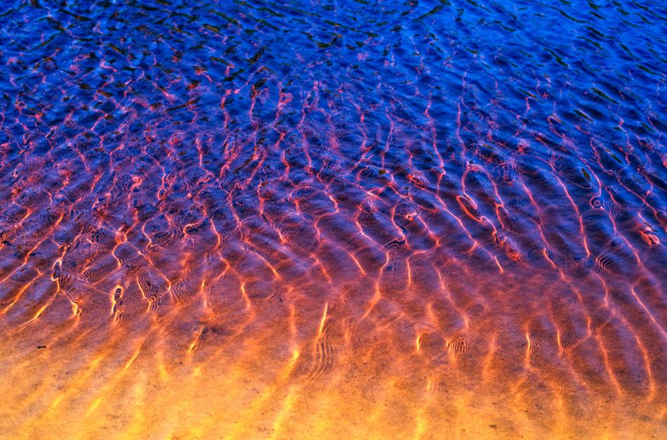
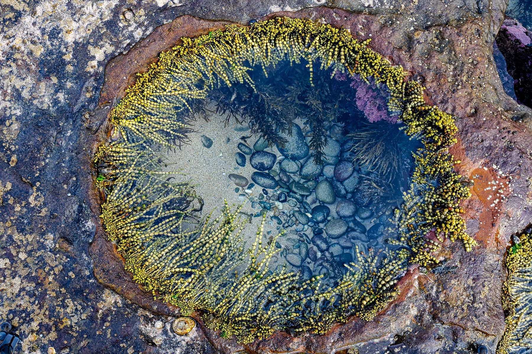
Coastal rockpool, Bournda National Park, south coast NSWSC114 Rockpool, Bournda National Park NSW1000,667
-
Rock formations near Saltwater Creek, Ben Boyd National Park on the south coast of NSW near the town of Eden was established in 1971. Originally 8,900 hectares in size, it has been expanded to 10,486 hectares. It is an area of Geolgical sites of NSW.SC115 Sunrise, Ben Boyd National Park NSW950,620
-
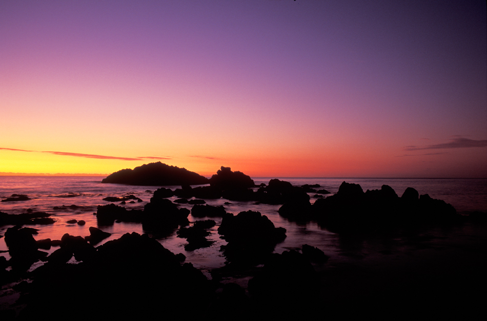
Nadgee Nature Reserve is a protected area on the far south coast of New South Wales, to the immediate south of Ben Boyd National Park. Its southern border is the state border with Victoria, where it abuts Croajingolong National Park.
A short scenic drive from the town of Wonboyn past Wonboyn Lakes through Nadgee Nature Reserve brings you to Greenglades on Disaster Bay - four kilometres of pristine beach.
SC116 Sunrise, Disaster Bay, Nadgee Nature Reserve, NSW950,626 -
Cooloola Recreation Area, Great Sandy National Park, is located between Noosa Heads and Rainbow Beach.SC117 Cooloola Recreation Area, Great Sandy National Park, Queensland950,618
-
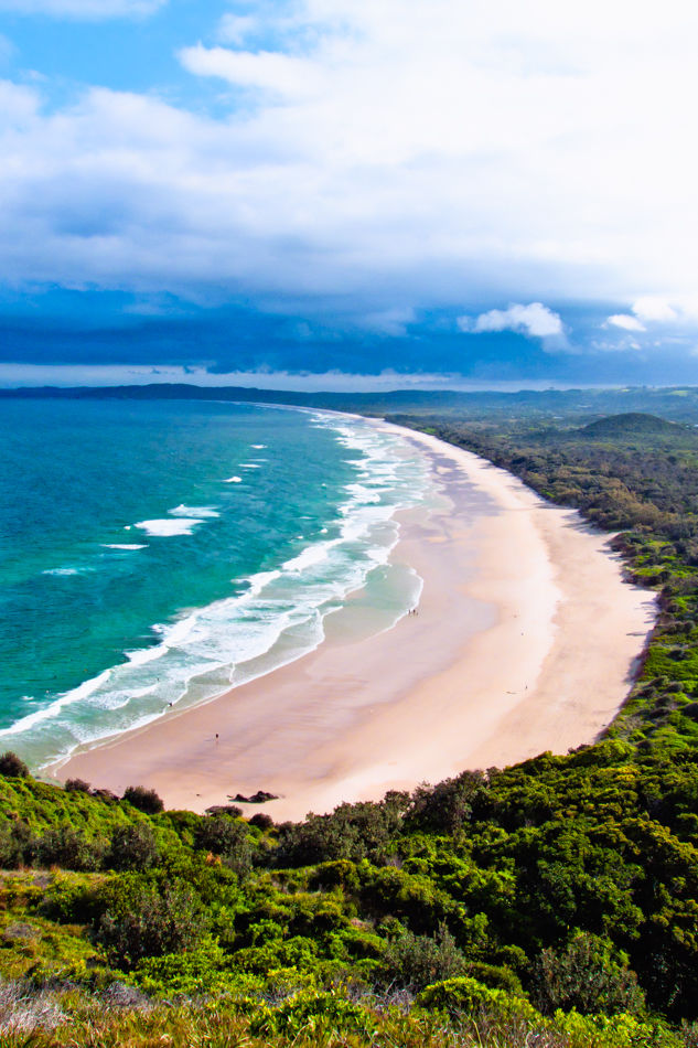
Yuraygir National Park NSW on the north coast between Yamba and Coffs Harbour, has the state’s longest stretch of undeveloped coastline.SC118 Sunrise, Yuraygir National Park NSW1000,667
-
Yuraygir National Park NSW on the north coast between Yamba and Coffs Harbour, has the state’s longest stretch of undeveloped coastline.SC119 Tannin Coloured Estuary, Yuraygir National Park NSW950,626
-
Yuraygir National Park NSW on the north coast between Yamba and Coffs Harbour, has the state’s longest stretch of undeveloped coastline.SC120 Seascape, Yuraygir National Park NSW1000,667
-
Mimosa Rocks is a national park in New South Wales, Australia, 329 km southwest of Sydney near the towns of Tathra and Bermagui.SC121 Dawn, Mimosa Rocks National Park NSW950,627
-
Seal Rocks is a small coastal settlement in the Great Lakes Council local government area, in the Mid North Coast/Hunter regions of New South Wales, Australia, 275 kilometres north-north-east of Sydney.SC122 Boat Beach, Seal Rocks NSW950,622
-
Bundjalung National Park is on the north coast of New South Wales, Australia, 554 km north-east of Sydney. It protects an area of coastal plain, heathland and solitary beaches between the towns of Iluka and Evans Head.
The Bundjalung people (aka Bunjalung, Badjalang & Bandjalang) are Australian Aborigines who are the original custodians of northern coastal areas of New South Wales (Australia), located approximately 550 kilometres (340 mi) northeast of Sydney: an area that includes the Bundjalung National Park and Mount Warning (known to the Bundjalung people as Wollumbin ("rainmaker").
SC123 Bundjalung National Park NSW950,635 -
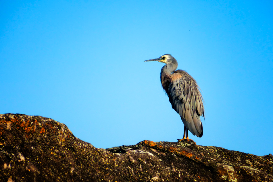
Bundjalung National Park is on the north coast of New South Wales, Australia, 554 km north-east of Sydney. It protects an area of coastal plain, heathland and solitary beaches between the towns of Iluka and Evans Head.
The Bundjalung people (aka Bunjalung, Badjalang & Bandjalang) are Australian Aborigines who are the original custodians of northern coastal areas of New South Wales (Australia), located approximately 550 kilometres (340 mi) northeast of Sydney: an area that includes the Bundjalung National Park and Mount Warning (known to the Bundjalung people as Wollumbin ("rainmaker").
SC124 White Faced Heron, Bundjalung National Park NSW950,635 -
Bundjalung National Park is on the north coast of New South Wales, Australia, 554 km north-east of Sydney. It protects an area of coastal plain, heathland and solitary beaches between the towns of Iluka and Evans Head.
The Bundjalung people (aka Bunjalung, Badjalang & Bandjalang) are Australian Aborigines who are the original custodians of northern coastal areas of New South Wales (Australia), located approximately 550 kilometres (340 mi) northeast of Sydney: an area that includes the Bundjalung National Park and Mount Warning (known to the Bundjalung people as Wollumbin ("rainmaker").
SC125 Sea Rocks, Bundjalung National Park NSW950,635 -
Bundjalung National Park is on the north coast of New South Wales, Australia, 554 km north-east of Sydney. It protects an area of coastal plain, heathland and solitary beaches between the towns of Iluka and Evans Head.
The Bundjalung people (aka Bunjalung, Badjalang & Bandjalang) are Australian Aborigines who are the original custodians of northern coastal areas of New South Wales (Australia), located approximately 550 kilometres (340 mi) northeast of Sydney: an area that includes the Bundjalung National Park and Mount Warning (known to the Bundjalung people as Wollumbin ("rainmaker").
SC126 Rock Platform, Bundjalung National Park NSW635,950 -
Bundjalung National Park is on the north coast of New South Wales, Australia, 554 km north-east of Sydney. It protects an area of coastal plain, heathland and solitary beaches between the towns of Iluka and Evans Head.
The Bundjalung people (aka Bunjalung, Badjalang & Bandjalang) are Australian Aborigines who are the original custodians of northern coastal areas of New South Wales (Australia), located approximately 550 kilometres (340 mi) northeast of Sydney: an area that includes the Bundjalung National Park and Mount Warning (known to the Bundjalung people as Wollumbin ("rainmaker").
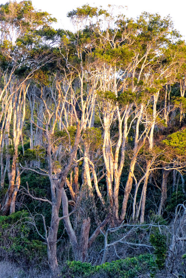
SC127 Paperbark Trees, Bundjalung National Park NSW635,950 -
Byron Bay is a beachside town located in the far-northeastern corner of the state of New South Wales, Australia. It is located 772 kilometres north of Sydney and 165 kilometres south of Brisbane.SC128 Byron Bay NSW633,950
-
Murramarrang National Park New South Wales Australia. South Coast NSWSC129 Rockpool1800,1200
-
Rock formations near Saltwater Creek, Ben Boyd National Park on the south coast of NSW near the town of Eden was established in 1971. Originally 8,900 hectares in size, it has been expanded to 10,486 hectares. It is an area of Geolgical sites of NSW.SC130 Dawn, Ben Boyd National Park NSW625,950
-
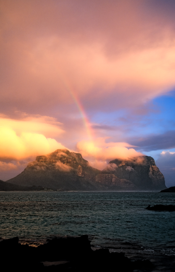
The Lord Howe Island Group is recorded by UNESCO as a World Heritage Site of global natural significance. Most of the island is virtually untouched forest with many of the plants and animals found nowhere else in the world. Other natural attractions include the diversity of its landscapes, the variety of upper mantle and oceanic basalts, the world's southernmost barrier coral reef, nesting seabirds, and its rich historical and cultural heritage. The Lord Howe Island Act of 1981 established a "Permanent Park Preserve" (covering approximately 70 per cent of the island). The surrounding waters are a protected region designated the Lord Howe Island Marine Park.SC131 Rainbow at Sunset, Lord Howe Island NSW611,950
-
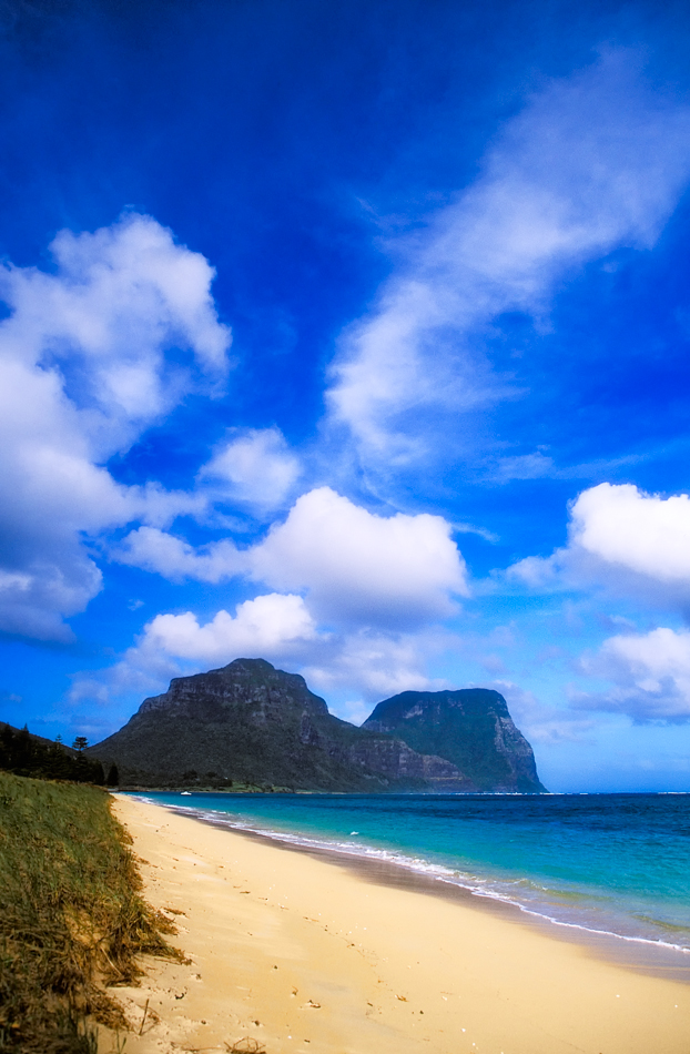
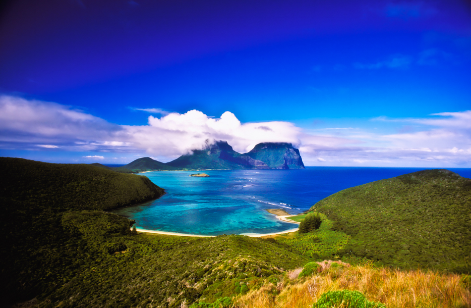
The Lord Howe Island Group is recorded by UNESCO as a World Heritage Site of global natural significance. Most of the island is virtually untouched forest with many of the plants and animals found nowhere else in the world. Other natural attractions include the diversity of its landscapes, the variety of upper mantle and oceanic basalts, the world's southernmost barrier coral reef, nesting seabirds, and its rich historical and cultural heritage. The Lord Howe Island Act of 1981 established a "Permanent Park Preserve" (covering approximately 70 per cent of the island). The surrounding waters are a protected region designated the Lord Howe Island Marine Park.SC132 Beach & Mt Lidgbird and Mt Gower, Lord Howe Island NSW622,950
-
The Lord Howe Island Group is recorded by UNESCO as a World Heritage Site of global natural significance. Most of the island is virtually untouched forest with many of the plants and animals found nowhere else in the world. Other natural attractions include the diversity of its landscapes, the variety of upper mantle and oceanic basalts, the world's southernmost barrier coral reef, nesting seabirds, and its rich historical and cultural heritage. The Lord Howe Island Act of 1981 established a "Permanent Park Preserve" (covering approximately 70 per cent of the island). The surrounding waters are a protected region designated the Lord Howe Island Marine Park.SC133 Mt Lidgbird and Mt Gower, Lord Howe Island950,616
-
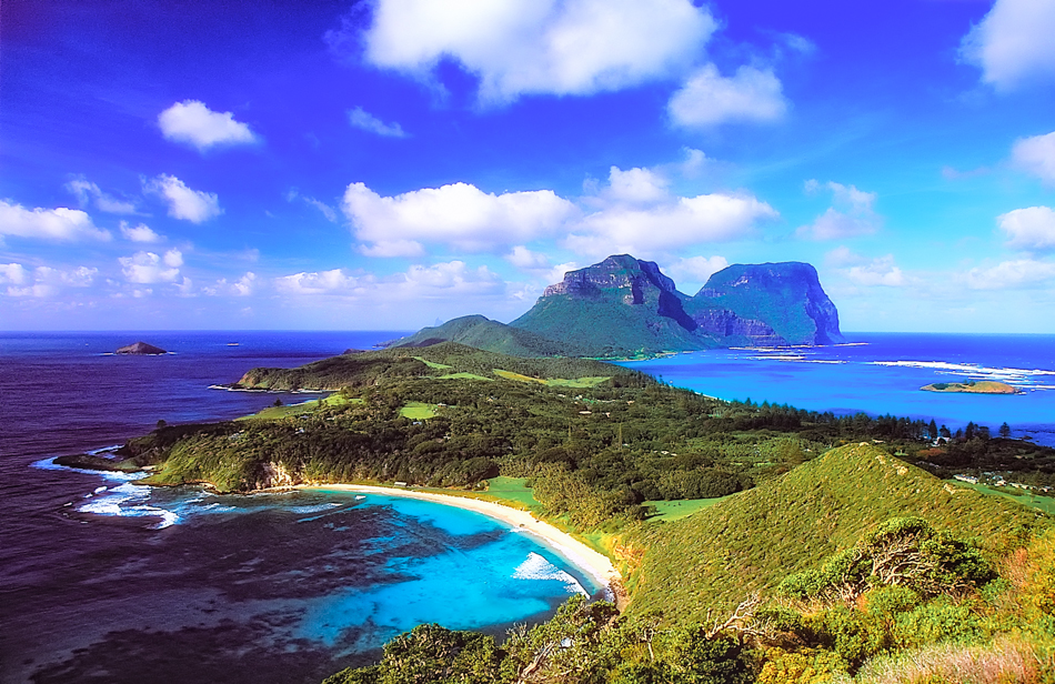
The Lord Howe Island Group is recorded by UNESCO as a World Heritage Site of global natural significance. Most of the island is virtually untouched forest with many of the plants and animals found nowhere else in the world. Other natural attractions include the diversity of its landscapes, the variety of upper mantle and oceanic basalts, the world's southernmost barrier coral reef, nesting seabirds, and its rich historical and cultural heritage. The Lord Howe Island Act of 1981 established a "Permanent Park Preserve" (covering approximately 70 per cent of the island). The surrounding waters are a protected region designated the Lord Howe Island Marine Park.SC134 View from the summit of Mt Eliza, Lord Howe Island NSW950,622
-
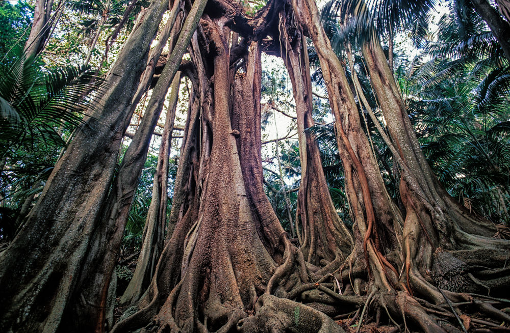
The Lord Howe Island Group is recorded by UNESCO as a World Heritage Site of global natural significance. Most of the island is virtually untouched forest with many of the plants and animals found nowhere else in the world. Other natural attractions include the diversity of its landscapes, the variety of upper mantle and oceanic basalts, the world's southernmost barrier coral reef, nesting seabirds, and its rich historical and cultural heritage. The Lord Howe Island Act of 1981 established a "Permanent Park Preserve" (covering approximately 70 per cent of the island). The surrounding waters are a protected region designated the Lord Howe Island Marine Park.SC135 Banyan Tree, Lord Howe Island NSW1000,654
-
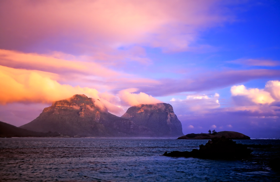
The Lord Howe Island Group is recorded by UNESCO as a World Heritage Site of global natural significance. Most of the island is virtually untouched forest with many of the plants and animals found nowhere else in the world. Other natural attractions include the diversity of its landscapes, the variety of upper mantle and oceanic basalts, the world's southernmost barrier coral reef, nesting seabirds, and its rich historical and cultural heritage. The Lord Howe Island Act of 1981 established a "Permanent Park Preserve" (covering approximately 70 per cent of the island). The surrounding waters are a protected region designated the Lord Howe Island Marine Park.SC136 Sunset, Mt Lidgbird and Mt Gower, Lord Howe Island NSW950,619
-
Remarkable Rocks are in Flinders Chase National Park on Kangaroo island.
Kangaroo Island is Australia's third-largest island, after Tasmania and Melville Island. It lies in the state of South Australia 112 km (70 mi) south-west of Adelaide.
SC137 Remarkable Rocks, Kangaroo Island South Australia950,626 -
Remarkable Rocks are in Flinders Chase National Park on Kangaroo island.
Kangaroo Island is Australia's third-largest island, after Tasmania and Melville Island. It lies in the state of South Australia 112 km (70 mi) south-west of Adelaide.
SC138 Remarkable Rocks, Kangaroo Island South Australia.950,625 -
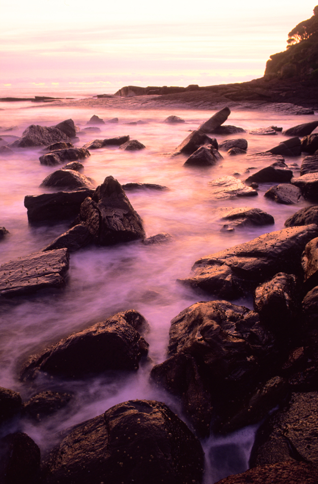
Rock formations near Saltwater Creek, Ben Boyd National Park on the south coast of NSW near the town of Eden was established in 1971. Originally 8,900 hectares in size, it has been expanded to 10,486 hectares. It is an area of Geolgical sites of NSW.SC139 City Rock area, Ben Boyd National Park NSW.633,950
-
Rock formations, Ben Boyd National Park on the south coast of NSW near the town of Eden was established in 1971. Originally 8,900 hectares in size, it has been expanded to 10,486 hectares. It is an area of Geolgical sites of NSW.SC140 Ben Boyd National Park NSW.640,960
-
Rock formations near Saltwater Creek, Ben Boyd National Park on the south coast of NSW near the town of Eden was established in 1971. Originally 8,900 hectares in size, it has been expanded to 10,486 hectares. It is an area of Geolgical sites of NSW.SC141 City Rock area, Ben Boyd National Park NSW.623,950
-
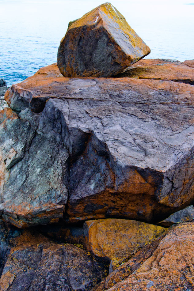
Rock formations near Saltwater Creek, Ben Boyd National Park on the south coast of NSW near the town of Eden was established in 1971. Originally 8,900 hectares in size, it has been expanded to 10,486 hectares. It is an area of Geolgical sites of NSW.SC142 Beach Rocks, Ben Boyd National Park NSW630,950
-
Rock formations near Saltwater Creek, Ben Boyd National Park on the south coast of NSW near the town of Eden was established in 1971. Originally 8,900 hectares in size, it has been expanded to 10,486 hectares. It is an area of Geolgical sites of NSW.SC143 City Rock area, Ben Boyd National Park NSW628,950
Exit Stack View


